Map · August 28, 2026 · 16 min read
Every New Location the GTA 6 Extended Look Revealed
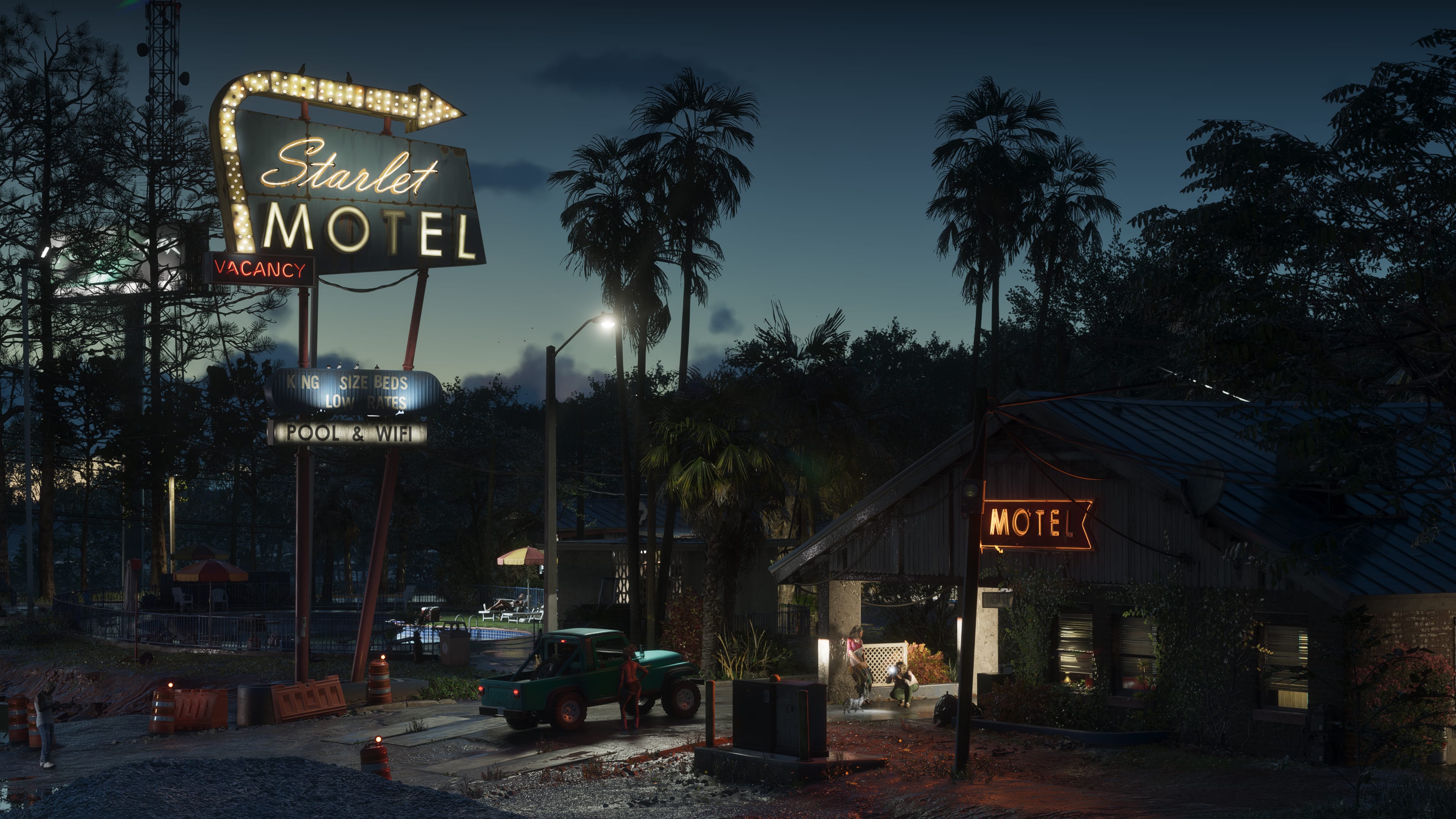
Port Gellhorn's boardwalk, a Grassrivers airboat dock, and the causeway linking Vice City to the Keys all got their first real screen time. Here is every location that debuted in the presentation, region by region.
Two trailers gave Leonida's six regions individual postcard moments. The Extended Look is the first time several of them got sustained screen time inside a single continuous sequence, which makes this the best geography update this site has published since the region names themselves were confirmed.
The single biggest reveal is structural rather than a named place: the causeway connecting Vice City to the Leonida Keys, crossed on screen in one unbroken shot. It had been theorized in fan cartography for years and is now something you can point to a timestamp for.
Port Gellhorn gets the most new square footage in this video - a boardwalk strip, working dock cranes, and a boat launch that reads as the region's actual entry point from the water, distinct from the faded-resort framing this site covered when the region was first named.
Vice City and the Keys both get incremental additions rather than a full reveal, which tracks with how much of those two regions Trailer 2 already covered. Grassrivers and Mount Kalaga get brief glimpses; Ambrosia does not appear in this video at all.
New this video, by region
- Vice City: a nightclub exterior and a dense sidewalk foot-chase block not previously shown in this level of detail.
- Causeway (unnamed on screen): the connective route between Vice City and the Leonida Keys, crossed in one continuous shot.
- Leonida Keys: brief coastal-road footage during the connective drive, consistent with earlier Keys imagery.
- Port Gellhorn: a boardwalk strip, dock cranes, and a boat launch - the region's clearest look yet.
- Grassrivers: a short storm-affected wetland shot, mostly atmosphere rather than new landmarks.
- Mount Kalaga: a brief tree-line silhouette visible in a wide shot; no new named landmark.
- Ambrosia: not shown in this video.
The causeway, and what it implies
A physical, drivable connection between Vice City and the Keys shown on screen answers a specific cartography question fans have argued over since the six regions were first named: whether the state's geography would be genuinely continuous or a series of disconnected pockets stitched together by loading transitions. On this evidence, at least one major route is continuous.
It does not resolve whether every region connects this cleanly. Ambrosia's absence from this video means its links to the rest of the map remain exactly as speculative as they were before August 27.
Port Gellhorn's upgrade
Earlier coverage on this site described Port Gellhorn primarily through faded-resort framing - a coastal region defined by decline rather than industry. The boardwalk and dock footage in this video adds a working-waterfront layer to that picture without replacing it. Both readings can be true of the same region; Rockstar just showed more of the second one this time.
Region identity beyond postcards
For “Every New Location the GTA 6 Extended Look Revealed,” treat officially named Leonida regions as identity anchors rather than postcard checklists. Tourist glitter, working waterfronts, wetlands, and inland corridors can share a state fantasy without identical density.
Carry forward only the map details Rockstar has published. Decorative screenshots illustrate atmosphere; they do not finalize road networks or interior counts.
Travel modes and geography
Visible boats, highways, and aircraft in marketing related to “Every New Location the GTA 6 Extended Look Revealed” suggest multi-modal travel across Leonida, but exact unlock rules and traversal systems remain unconfirmed unless Rockstar states them.
Geography analysis should note choke points and biome shifts without inventing timed trial lists or unreleased vehicle classes. What you can see is evidence; what you wish to drive is not.
Fan maps versus official names
Fan cartography around “Every New Location the GTA 6 Extended Look Revealed” is useful as hypothesis and poor as citation. Prefer Rockstar's published names and trailer-visible landmarks when teaching readers the state.
When a community map disagrees with official labeling, the official label wins until Rockstar updates it. Do not present reconstructed borders as confirmed for the November 19 launch marketing kit.
Open questions for cartographers
Scale, verticality, interior density, and how districts connect under free-roam pressure remain open even after strong trailer geography. List those as questions, not as solved lore.
Grand Theft Auto VI remains scheduled for November 19, 2026 on PlayStation 5 and Xbox Series X|S unless a newer Rockstar or Take-Two update supersedes that plan. Map speculation should never be framed as a reason the console date moved. Cartographic uncertainty is normal this far from release.
Related dispatches
Map · 16 min
How Big Is the GTA 6 Map? Why Every Square-Mile Claim Is Still a Guess
Three times Red Dead, twice GTA 5, the size of Florida - none of those figures is a Rockstar measurement. Here is what six named regions plus one causeway drive actually prove.
Map · 16 min
Dalton Island to Catalan Key: New Names on the Cyberleek Map
After the 'full map' still, Cyberleek posted cropped labels: Dalton Island, Tequesta Retreat, Gloriana Key, Catalan Key. Here is how to file those names against the six regions Rockstar has actually published.
Map · 16 min
How Leonida Roasts Florida: Tourism, Influencers & Sunshine-State Satire
Vice City is not a Miami postcard with the labels peeled off. It is a satire of a state that sells paradise while filming itself. Here is the geography of that joke.